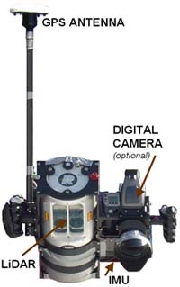
Handheld Airborne Mapping System
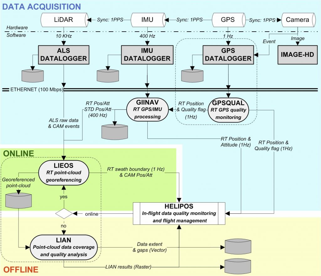
This small, flexible and accurate airborne mapping system integrates laser scanner (LiDAR), digital imagery and navigation sensors (GPS/INS). This system was developed to implement and test innovative mapping concepts, namely:
- real-time creation of laser-point cloud with cm-level accuracy
- in-flight quality assessment of laser data – basic (i.e. swath, mapping coverage, point-density)
- in-flight quality assememtn of laser data – advanced (i.e. 3D point accuracy, DTM quality map)
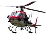
Once embarked onto a helicopter the system provides autonomous surface mapping of an area of interest with a high precision (<0.2m) and resolution (<1m²). Its domain of application spans from natural hazards to corridors mapping. The main conceptual advantages of the system can be summarized to the following points:
- Lightweight handheld mapping system combining GPS/INS/ALS with high resolution digital camera (sensor block on carbon-aluminium structure: 70x50x30 cm / 12kg), uninterrupted power supply and custom data storage.
- Specific setup for small-scale airborne surveying: Natural hazards mapping, corridor-mapping (power lines, railroads, highways, etc.), open pit mines, gravel pits (periodic determination of extracted volume), forestry (oblique ALS-mapping allows to gather more information about the canopy).
- No specific installation on the helicopter needed: very little installation time (<30min), fast deployment on a short notice.
- Oblique and nadir surveying can be performed with little change in configuration.
- Real-time georeferencing of laser-point cloud with cm-level accuracy.
- In-flight determination of laser-point cloud density and its quality.
- In-flight determination of DSM and DTM and its quality.
(see also page of technology transfer)