Scan2map started in 2005 as a test-bed platform for development and testing innovative concepts in (mainly airborne) mobile mapping. Some were directly transferred to the industry while others landed as a public knowledge via publications – to emerge later also as a part of products or services.
This page provides a short overview of main “Scan2map” milestones in a chronological order.
Platforms
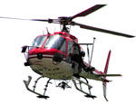 | Helicopter-based handheld airborne mapping system This small, flexible and accurate airborne mapping system integrates laser scanner (LiDAR), digital imagery and navigation sensors (GPS/INS). This system serves in development, implementation and testing of innovative mapping concepts. |
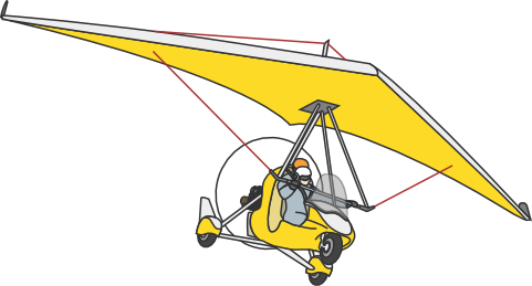 | Ultralight aircaraft (ULM)-based multispectral and hyperspectral remote sensing platform Powerful and versatile remote sensing platform developed as part of the ULM: Léman-Baïkal project. |
 | Unmanned aerial vehicle (UAV)-based remote sensing and direct georeferencing platform Long-term advanced research and system prototyping platform. |