Environmental monitoring and modelling is one of the specialisation of the SIE curriculum.
Geomatic technology is playing a key role in geodata acquisition and monitoring of the built and natural environment.
This sections gathers all the research topics related to GNSS networks, laser scanning and mobile mapping systems (land-based, airborne, micro UAVs).
Some project examples :
Terrain Type Modeling for Automated Tie-point
Detection in Aerial Photogrammetry
Photogrammetry consists in creating 3D models out of overlapping photos of an object (this object could be a crop seen by above, a building, a statue…). The 3D position of distinctive features on the object is determined via multiple observations of a set of Tie-points identified and matched in multiple images.
The texture of the object is fundamental for photogrammetry. For instance, it’s not possible to detect tie-points on an object without texture (water, sand), thus it’s not possible to create 3D models of these surfaces with photogrammetry. The goal of this semester-project is to quantify the quality of the texture of different materials (figure 1). Several quality estimators could be studied, for example, the number of tie-point and the precision of the determination of these tie-points in the image. The outcome of this project will permit to determine the precision of the final 3D model.
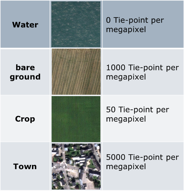
Figure 1: Order of magnitude of the number of tie-points detectable
between two consecutive photos for different type of terrains
The steps of this project may vary according to the student preferences:
- Literature review about tie-points detection and matching (SIFT, SURF algorithm).
- Experimentation with photogrammetric software (e.g., pix4D) or with computer vision toolbox (e.g., matlab)
- Statistics on experimental data to draw out general principles (with matlab, python or R)
Recommended type of project: Semester project (master students)
Work breakdown: 30% theory, 20% development, 50% experiments
Prerequisites: familiarity with computer-vision or photogrammetry, data-management with matlab, python or R
Keywords: photogrammetry, computer-vision, image processing, statistics
Contacts: Emmanuel Cledat
Monitoring ice coverage of lakes by combining image processing with radiometric indexes
The study of ice formation over lakes is complex. Though a human eye is good at differentiating open water from ice when seeing a satellite image, automatic computation does not always manage to make such classification properly. Indeed, the multispectral data available (for example, for Landsat 8) depends on the characteristics of the local atmosphere, as well as exterior parameters such as the wind speed above water.
A radiometric index coined NILI (Normalized Icy Lakes Index) has been tested with decent results on lake Onego (Russian Federation) at the Geodetic Engineering Lab of EPFL, but it still fails when the ice layer is too thin : its spectral signature can not be distinguished from the one of plain water. Yet, various hints can lead a human eye to understand what is ice what is water, like the presence of rough structures in the ice (cracks) versus the uniformity of the water. Although these differences can not be captured by pixelwise radiometry, image processing techniques (like levellings) can very well retrieve such local information and help the radiometric processes.
The purpose of this internship is to help in the development of full water-ice classification algorithm using both NILI and extra image processing. This includes (but is not limited to) the following tasks:
- Assess the performance of NILI on various Landsat 8 images of lake Onego and its usability on other sample lakes.
-
Incorporate mathematical morphology tools (like levellings) in the algorithm to refine the classification.
-
Discuss the performance of the algorithm (in terms of accuracy) and its adaptability to different lakes of the world.
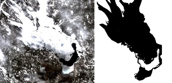
NILI classification over lake Onego (Russia).
Recommended type of project: Master thesis
Work breakdown: 20% theory, 30% software, 50% experimentation
Prerequisites: good level in image processing
Keywords: multispectral images, radiometry, image processing
Contacts: Kévin Barbieux
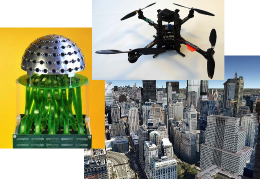
Mobile mapping using a UAV-mounted Panoptic camera
The terrestrial mapping of urban environments with a sub-decimeter accuracy remains largely an open problem due to the poor availability of a reliable GNSS signal in those scenarios. As a potential solution, the TOPO Lab is exploring the concept of a micro-UAV-aided mobile mapping platform. In particular, the trade-off between the wide field-of-view and the ground resolution of an airborne optical sensor constitutes a major constraint for the effective realization of such concept. Consequently, we consider the utilization of a breakthrough visual sensor recently developed by the Signal Processing (LTS2) and the Microelectronic Systems (LSM) laboratories at EPFL, namely the Panoptic camera, which facilitates an omnidirectional, three-dimensional perception of the surrounding, while allowing for a super-resolution information to be selectively extracted from the redundant visual data.
The proposed project aims at demonstrating the feasibility, as well as developing the necessary algorithmic workflow for a sub-decimeter localization of terrestrial objects using the visual data from a micro UAV-mounted panoptic camera.
Contacts: Pierre-Yves Gilliéron
Laser scanning and changes detection
Nowadays become the monitoring of unstable land and control structures become more and more important. In this context, it is necessary to estimate the state of land or built object changes and detect any abnormal or dangerous movement.
This semester project aimed to explore methods of processing laser data and derivatives useful for the interpretation of forms.
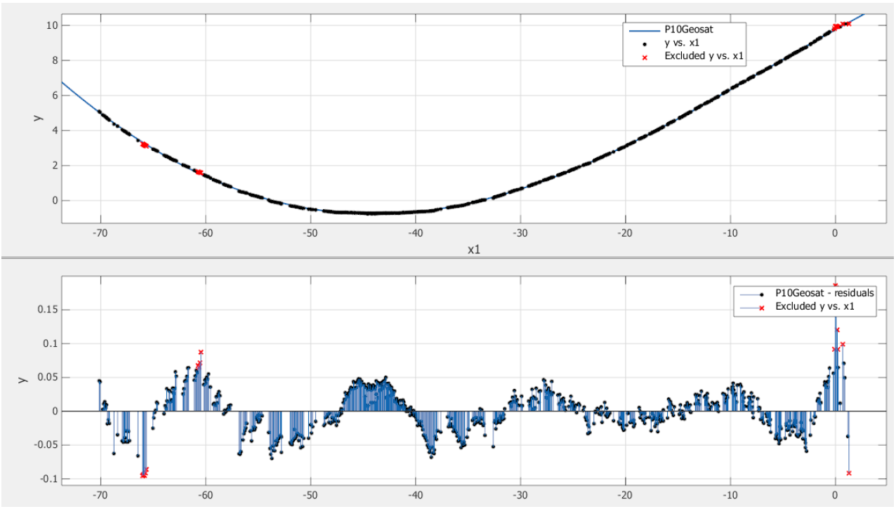
Regression of a horizontal profile of Toule’s reservoir
Contacts: Pierre-Yves Gilliéron
Contact/Proposal
If you have interest in this domain, please don’t hesitate to contact TOPO staff.
Visit IS-Academia project page for specific proposals.
Proposal: Evaluation de la méthode GPS-PPP (Precise Point Positioning) en région de montagne